I failed to find nearly enough evidence on "JSJI" (Little St. James Island) of the tunnel burial activity that Q had predicted -- to account for $100 K of "dirt work" (much less $29 milion!)...
~~~~~~~~~~~~~~~~~
Q #999 & #1000"Why is Epstein spending $29mm to bury the tunnels underneath (h)is temple on Epstein Island?
~~~~~~~~~~~~~~~~~
Simultaneously, I saw reports that in 2016, Epstein had also acquired "GSJI", (GREAT St. James Island) nearby -- so, I "took a look" over there with GE (Google Earth):
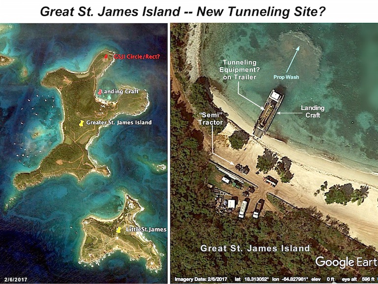
On the north side of GSJI, there's what appears to be nice, small, natural harbor -- so, I zoomed in on it...

To my surprise, there was a genuine military (surplus?) Landing Craft, beaching itself, and holding itself in place, churning up silt from the bottom with its prop wash.
Inside it, there was a flatbed trailer -- with what appears to be a tunnel boring machine on it. And, there. on the beach, was a semi-tractor truck, with its 5th wheel trailer hitch -- ready to back onto the landing craft and haul the trailer up that road toward the northern point of GSJI...
And there was already a set of tracks -- where another vehicle had recently made that same trip!
Some sort of construction was going on, because there were tractors, dump trucks, water trailers, excavators, etc.in a nearby lot and on the beach...
~~~~~~~~~~~~~~~
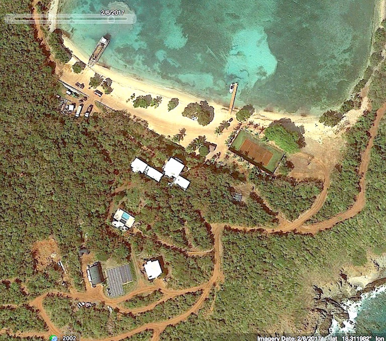
Just inland from the beach, there was a small settlement of new buildings, including a swimming pool and a solar panel array amid a tangle of dirt roads.

And -- on the beach (later destroyed by Hurricane Irma) -- another "Tennis Court"!
~~~~~~~~~~~~~~
The landing craft, etc., led me to check out that northernmost point of GSJI.
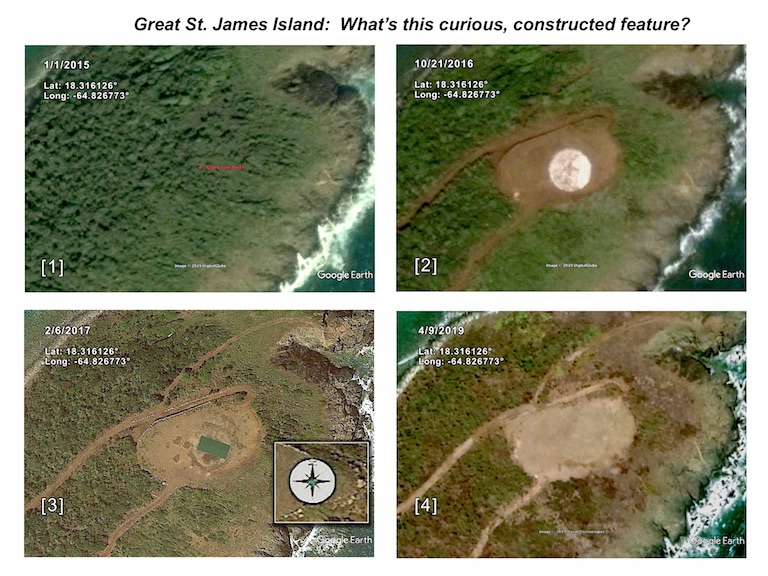
So -- Using GE -- I "followed" the northward road to the point marked "GSJI Circle.Rect?" on the "two islands" image above.
Then, using GE's "Time Slider" feature to examine images "across time" (a sequence of overflight image dates) the following temporal sequence was developed:

[1] 1/1/2015; Prior to Epstein's procurement of GSJI in 2016, that location was undisturbed forest.
[2] 10/24/2016: A small clearing with two access roads -- enclosing a circle: white, (probably concrete). NOTE: This was prior to the 2/6/2017 arrival of the landing craft with tunnel boring machine...
[3] 2/6/2017 (when the landing croat was on the beach) : A distinct rectangle, almost the same blue color as the metal "boxes (aka, "Bunker Forest Blue") found on LSJI (where tunnel boring machines began digging). The rectangle rests atop the partially-obscured circle, and is in a clearing, bounded on the north by neatly-placed rocks -- as shown in the inset, a common practice on LSJI...
NOTE: The circle in [2] resembles the "Compass Rose" on LSJI -- as shown in the inset in [3]...
[4] 4/29/2019 (the most recent overflight in the database): The rectangle is gone -- and the entire clearing has been covered over with a thin layer of dirt, through which the circle is still faintly visible.
~~~~~~~~~~~~~~~
BTW, while I was researching, I found Epstein's Formal "Architect's Site Development Plan" for GSJI! Check it out...
It seems that the "mystery area" above is to be a "Terrrace with Pavillion" -- and, it's shown as circular...
Rather an odd way of going about building such a thing -- don't you think? '-)
~~~~~~~~~~~~~~~
Now -- as Paul Harvey would say -- "The REST of the story":
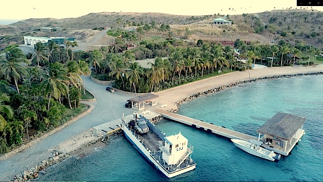
There's no way that Epstein can "disown" the "Landing Craft":

There it is -- in a mid-July 2019 Drone shot -- at the dock on LSJI, with the same (or a near-identical) semi-tractor onboard -- and, clearly labeled, "LSJ".
Unfortunately, that's just the beginning of the story of Epstein's activities on GSJI...